lakebbs

雷湾气爱

@user-346a05d7

This member hasn't written a bio

Joined January 2025
9Posts4Followers1Following23Likes
Open post
雷湾气爱
2025-03-23 11:42:47 EDT·What's new

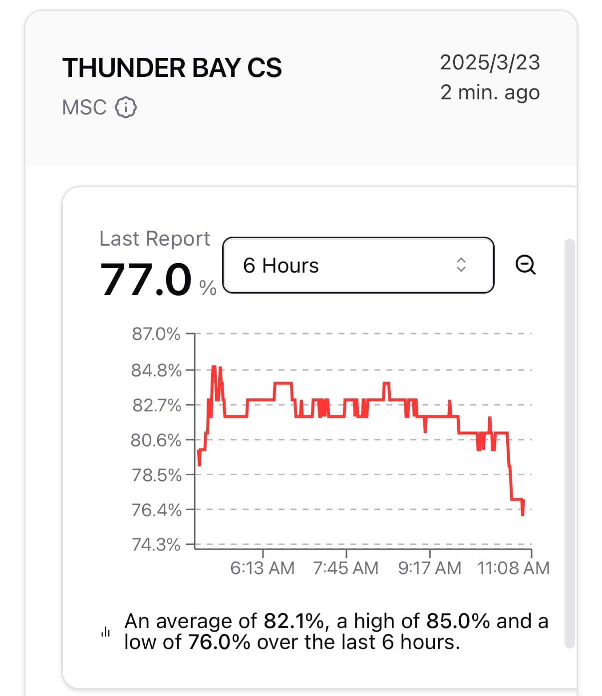
【Snow Squall Short-Term Forecast】Strong echoes rescue the dry zone operation

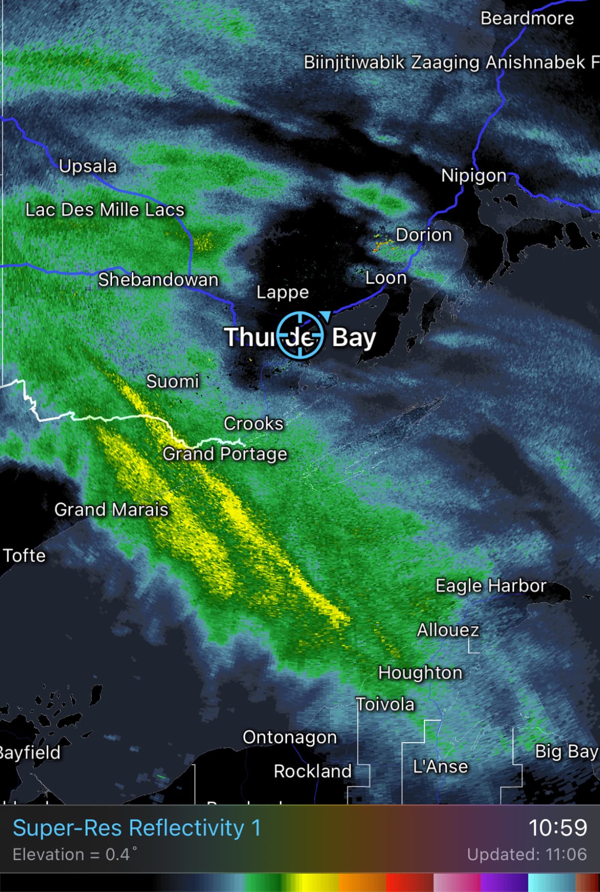
I believe many friends this morning noticed that the snow forecast seemed off? Actually, this is a limitation of weather models: they cannot well identify the "false echoes" caused by dry zones near the surface. Although the high-altitude warm and moist cloud layer has arrived (forming high-altitude echoes), the earlier dry and cold air mass has left a dry zone with relatively low humidity near the surface, which appears on radar as a "echo hole" ring around the radar station (Figure 1). For snow from aloft to reach the ground, it must pass the test of the dry zone and not be sublimated; and for warm and moist air to break through the dry zone's restriction, the only way is continuous "moisture replenishment" from strong echoes. This process has partially succeeded so far: light snow is falling. And according to the current
Like: 2Save: 0Comment: 0Views: 0
Open post
雷湾气爱
2025-03-23 04:47:03 EDT·What's new

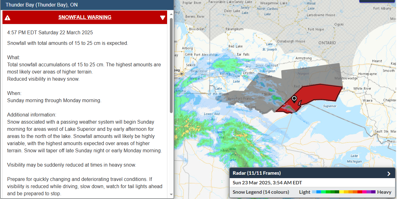
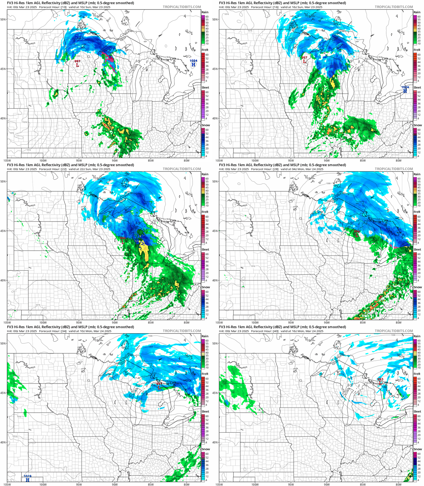
[Thunder Bay · Snowfall Warning] Colorado Low

Environment Canada has issued a snowfall warning for the northwest shore of Lake Superior (including Thunder Bay) (see Figures 1-2 for details). Based on mesoscale numerical models, we expect snow to begin this morning (Sunday) between 9-11 AM, with the heaviest snowfall lasting from this afternoon into early Monday morning. Snowfall will taper off during the day on Monday, though scattered light flurries may still occur. Additionally, due to the pressure gradient of the cyclone, Thunder Bay will experience easterly onshore gusts of 6-7 on the Beaufort scale from this afternoon into tonight. When heading out over the next two days, please be aware of the impact of snow accumulation on traffic.

Like: 1Save: 0Comment: 0Views: 0
Open post
雷湾气爱
2025-03-14 03:30:01 EDT·What's new

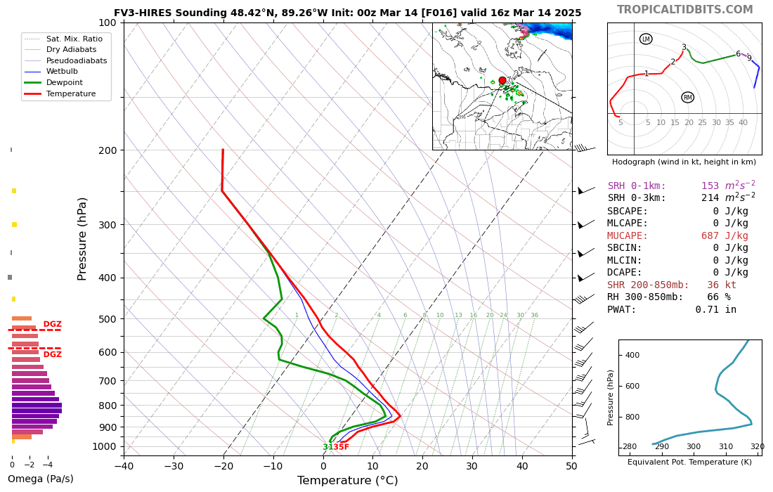
[Thunder Bay Severe Convection Personal Analysis #202501] Can Showery Convection Strike the First Thunder of the Season?

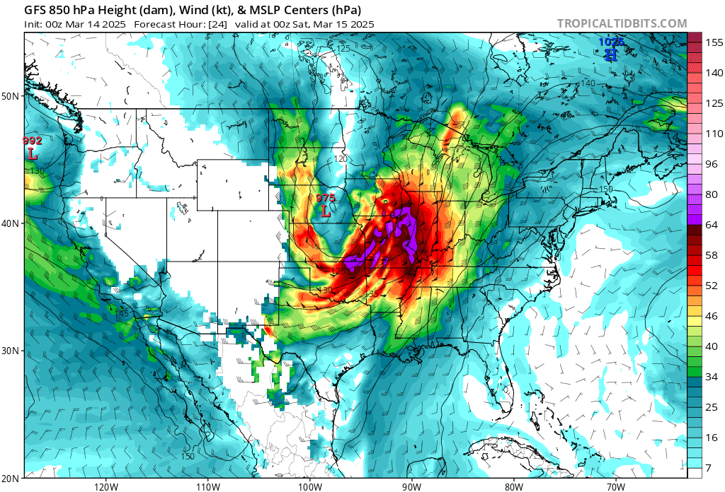
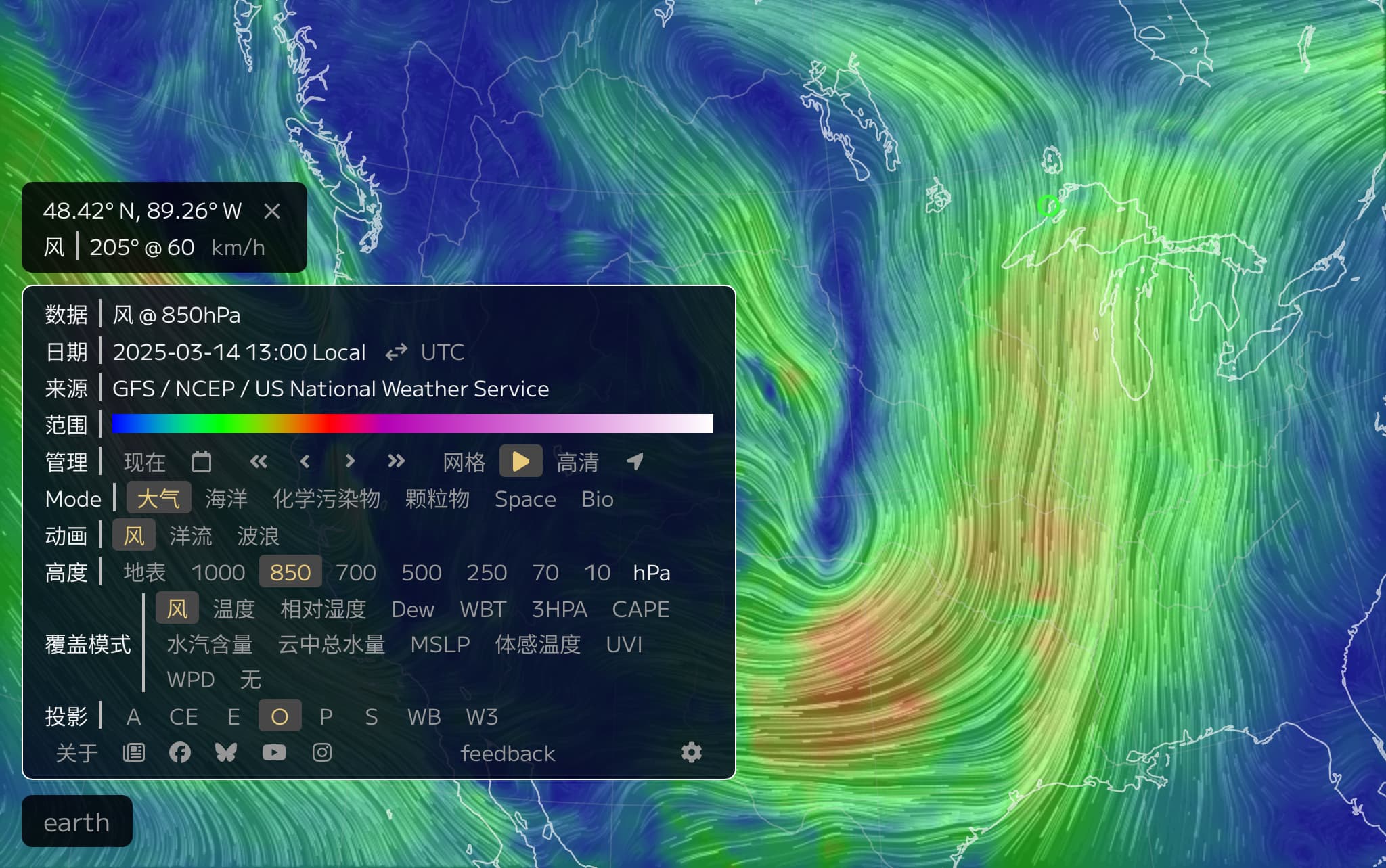
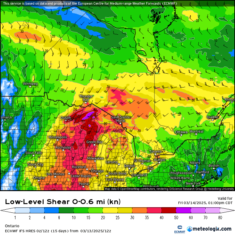
With the time zone adjustment this week, spring is drawing closer to Thunder Bay, and the clash between cold and warm air masses is intensifying. Overview: Influenced by the warm front of a cyclone, convective rainfall is expected in parts of Thunder Bay this afternoon (Friday the 14th), with isolated weak thunder or small ice pellets possible, maximum hourly rainfall intensity of 3-7 mm/h, and precipitation lasting no more than 1 hour. Since the area of severe convection is very localized and highly uncertain, the possibility of hail cannot be ruled out either; it is recommended to carry an umbrella at all times when going out today. Analysis: On the night of the 13th, east of the Rocky Mountains in the United States, a Colorado Low with an unusually large circulation was rapidly moving eastward and

+2
Like: 3Save: 0Comment: 1Views: 0
Open post
雷湾气爱
2025-02-28 12:13:41 EST·What's new

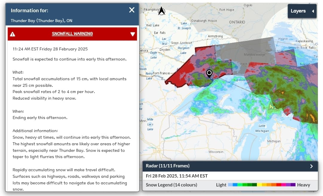
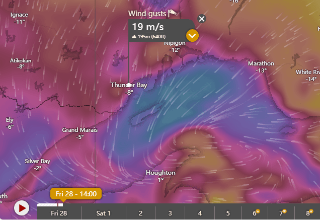
Thunder Bay - Snowfall Warning is currently in effect

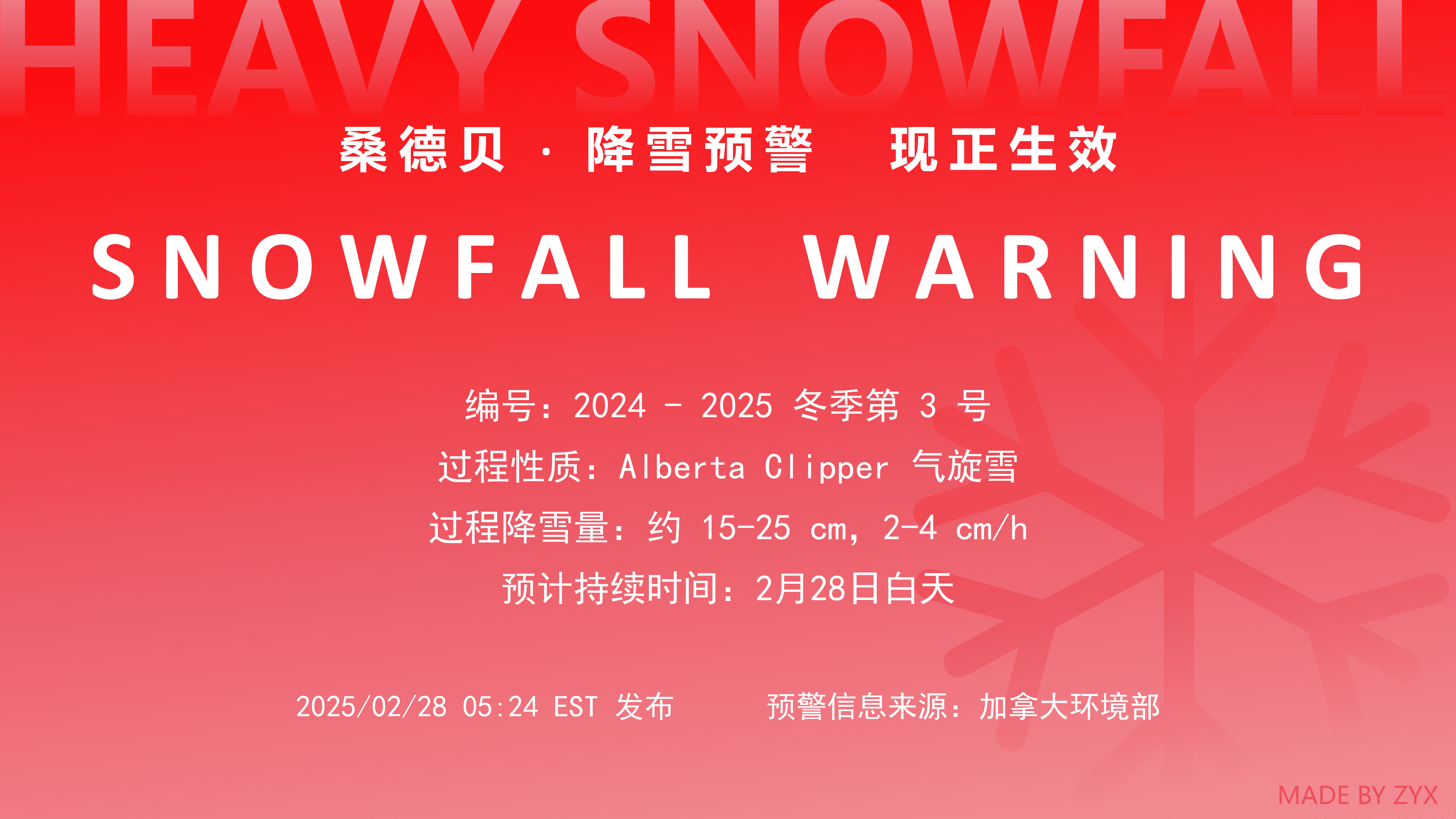
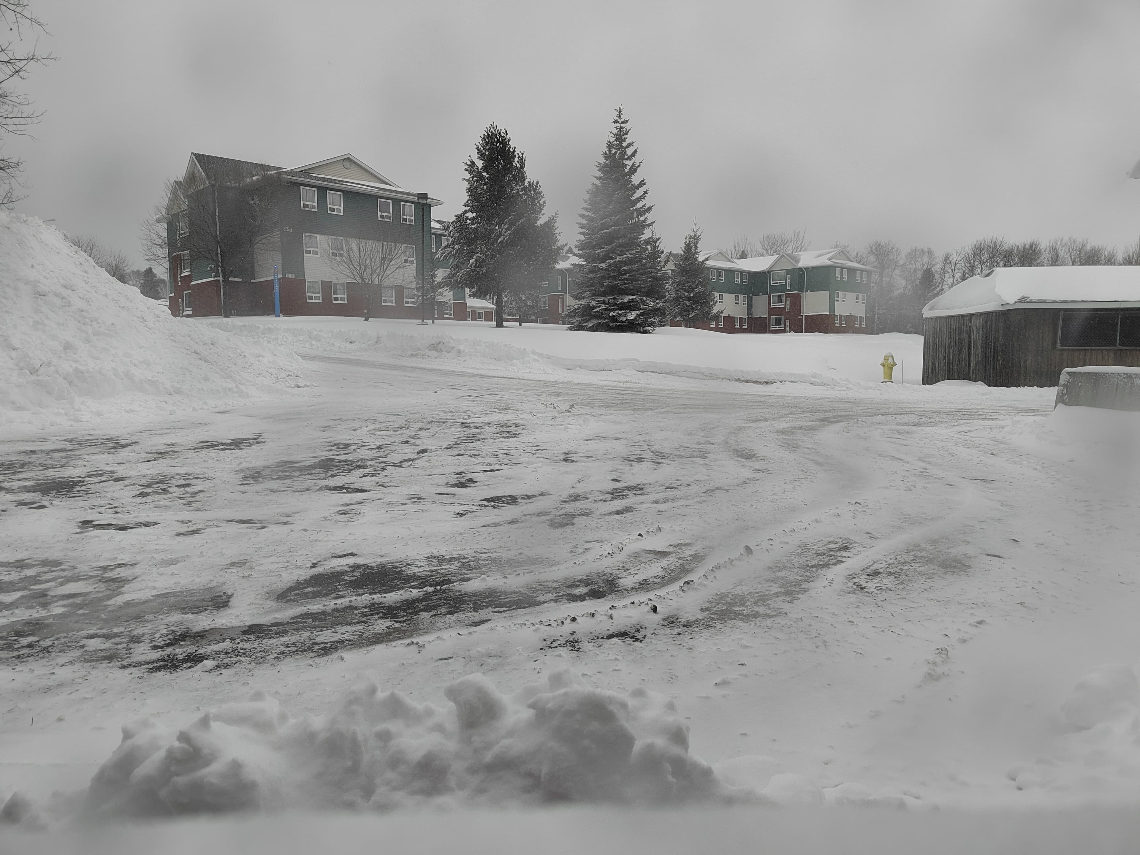
The details of the warning are shown in Figure 2. Thunder Bay has now entered the cold sector of the cyclone, and the peak snowfall period in the warm sector has passed. Snowfall is expected to turn into light flurries in the afternoon and gradually end, and the snowfall warning may be lifted in the afternoon. However, the severe weather in Thunder Bay is not over; what follows is continuously strengthening northeast gusts and a sharp temperature drop. The strongest gusts are expected from this afternoon to evening, with maximum gusts on land reaching force 8 (about 20 m/s), and over Lake Superior possibly exceeding force 9. Temperatures may drop by more than 10°C within 6 hours, and will fall below -10°C after nightfall. Tomorrow, Thunder Bay will turn partly cloudy to sunny, but in the early morning, due to clear-sky radiation, temperatures will be low, with a minimum of -1°C.

+2
Like: 4Save: 0Comment: 4Views: 0
Open post
雷湾气爱
2025-01-27 12:21:23 EST·What's new

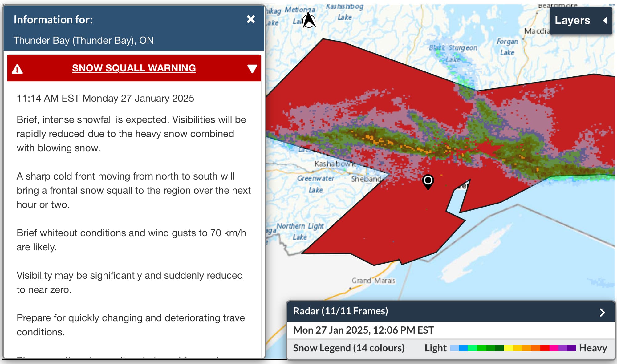
Thunder Bay • Snow Squall Warning

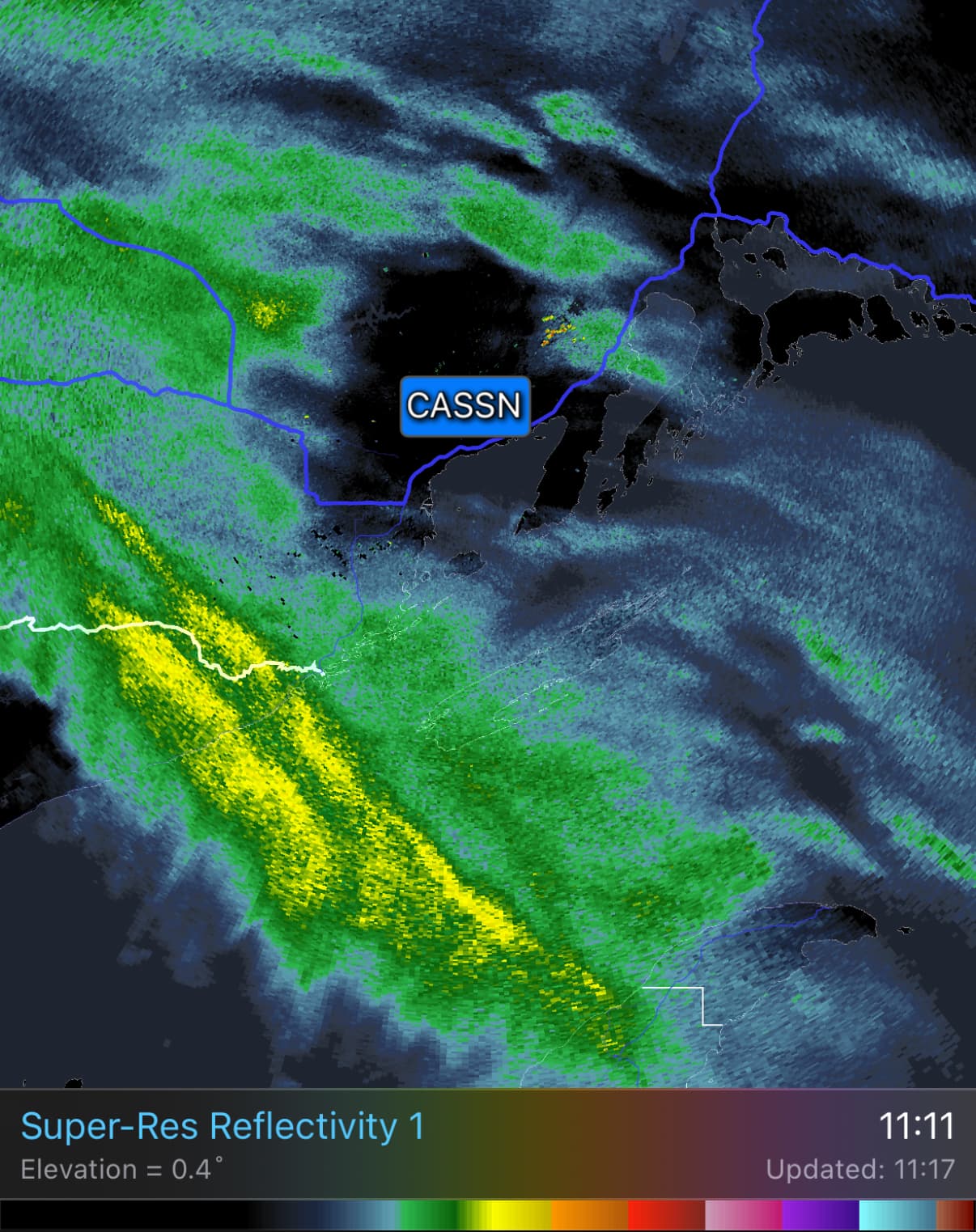
Environment Canada issued a snow squall warning for Thunder Bay at 11:14: due to a fast-moving low-level cold front moving south, heavy snow is expected to hit Thunder Bay within the next 1-2 hours, with gusts up to 70 m/s (Force 8) in open areas accompanied by low visibility, and the ground will quickly turn white. Based on current radar, we estimate the snow will reach downtown Thunder Bay in about half an hour. Please take precautions.

Like: 1Save: 0Comment: 0Views: 0
Open post
雷湾气爱
2025-01-21 18:00:23 EST·What's new

[Thunder Bay Weather] Extreme cold warning lifted, warm moisture starting to take hold, increased chance of snowfall over the next week

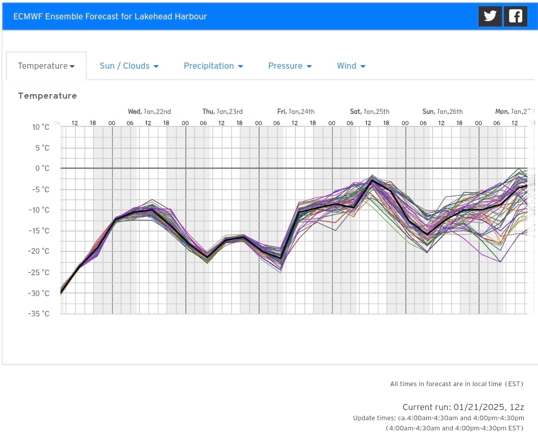
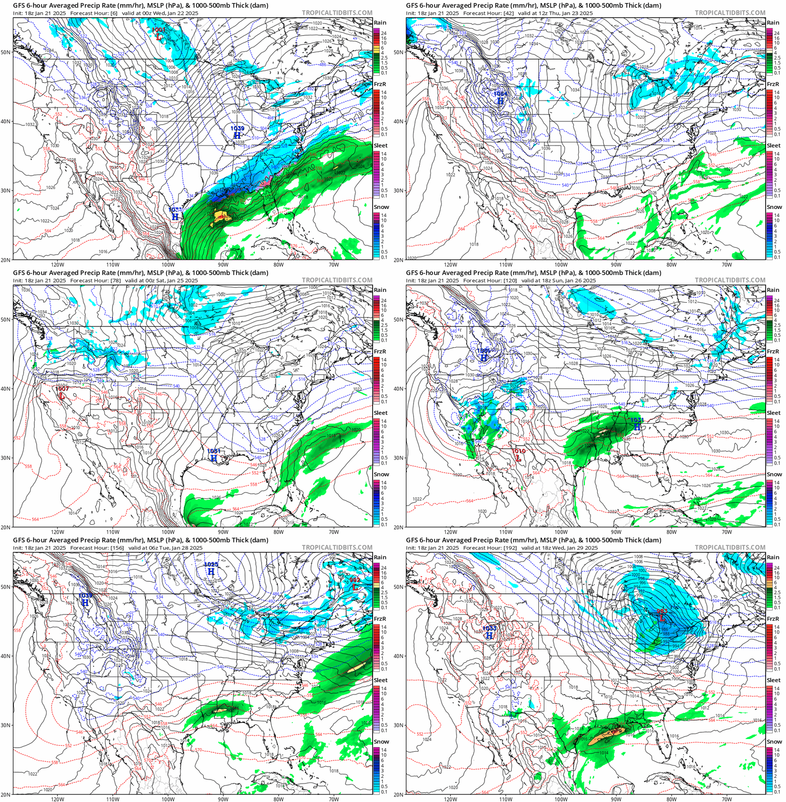
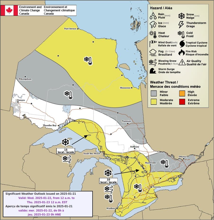
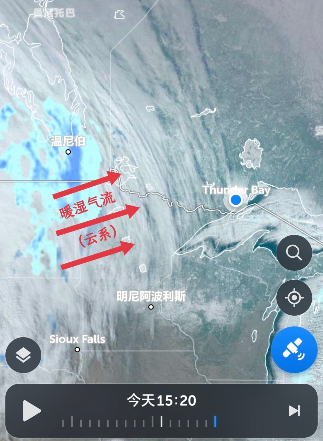
Although it may seem counterintuitive, in Thunder Bay's winter, "cloudy skies/starting to snow" and "warming up" are highly correlated: It is expected that after nightfall tonight, Thunder Bay's weather will gradually turn cloudy, signaling that the cold high-pressure system has officially lost its absolute control over Thunder Bay, while a new "Alberta Clipper" low-pressure system, along with warm moist air, is re-taking the weather stage. Currently, all major weather models support that from early to mid-morning tomorrow (Wednesday), this warm moist air will fill the near-surface dry zone created by the earlier cold air, with a chance of squeezing out a bit of light snow; at the same time, temperatures will rapidly rise from this morning's -30°C to around -10°C by tomorrow morning, shifting from extreme cold to normal cold. Looking ahead

Like: 3Save: 0Comment: 0Views: 0
Open post
雷湾气爱
2025-01-21 02:17:26 EST·What's new

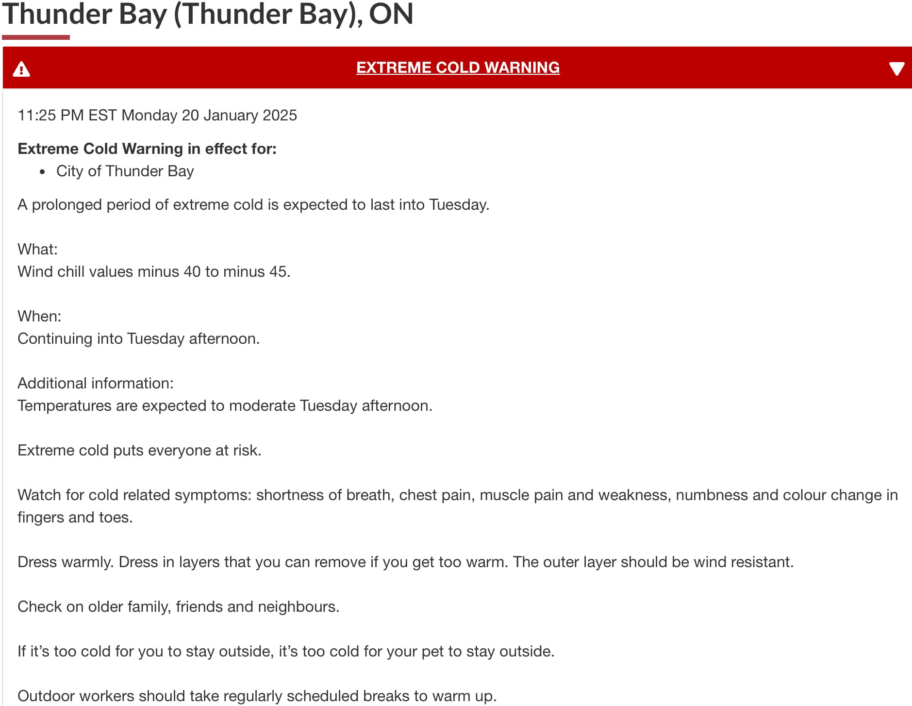
[Thunder Bay Extreme Cold Alert] Cover up! Brace for the final fury of the cold high-pressure system.

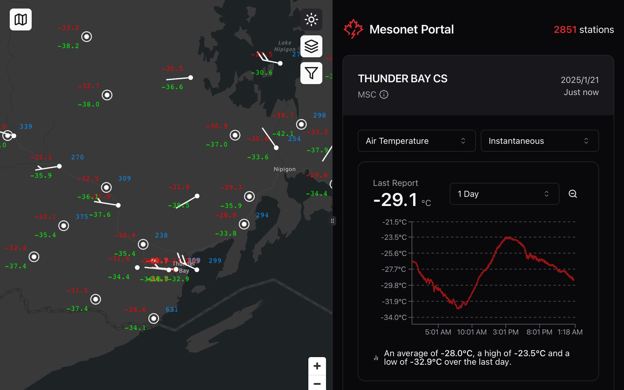
As we all know, due to clear-sky radiative cooling and the scattering effect of snow cover, clear mornings under a cold high-pressure system after snowfall are typically the coldest times of day. Thunder Bay has exemplified this perfectly over the past three days: the Thunder Bay National Weather Station at the airport has recorded temperatures below -30°C for two consecutive days, with yesterday (Monday) hitting a low of -32.8°C. The extreme cold warning for Thunder Bay remains in effect, and as of the time of this post, the station's temperature has dropped to -29.3°C, which is 2-3°C lower than at the same time yesterday. At this rate of radiative cooling, temperatures could fall below -35°C around sunrise between 8-9 AM this morning, which is really unfriendly for students heading to 8 AM classes. Going out in this extreme cold weather

Like: 2Save: 0Comment: 3Views: 0
Open post
雷湾气爱
2025-01-18 15:37:57 EST·What's new

Thunder Bay • Extreme Cold Warning

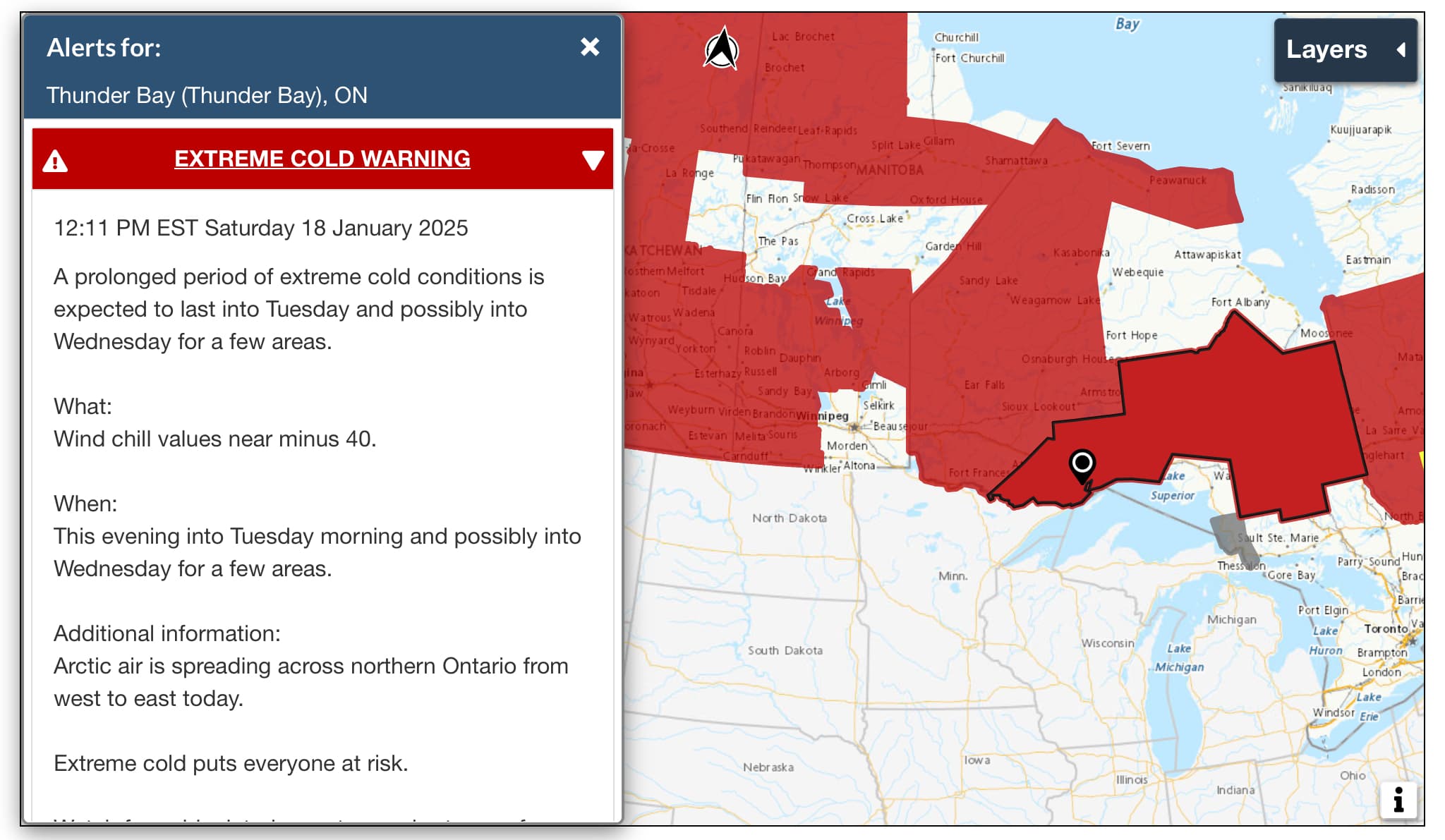
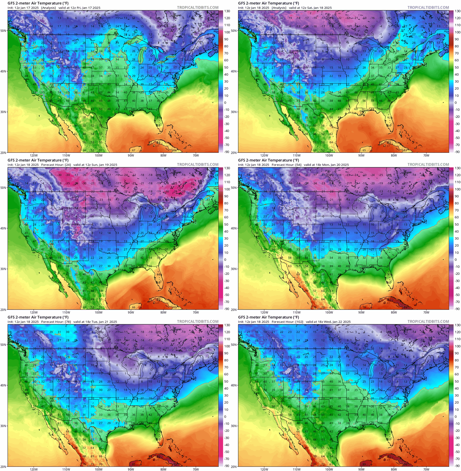
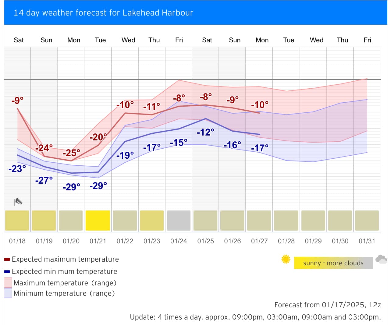
Environment Canada issued an extreme cold warning for Northern Ontario (including Thunder Bay) at 12:11 p.m. today: Due to the high-altitude Arctic polar vortex, starting tonight through Tuesday morning, the associated ground-level extreme cold high-pressure air mass will sweep across Northern Ontario from west to east, bringing clear but bitterly cold weather to Thunder Bay. Thunder Bay will experience three consecutive days of temperatures near or reaching -30°C, and with a light breeze, the wind chill could approach -40°C (meeting the regional extreme cold warning criteria). Due to the extreme cold, Loch Lomond Ski Resort has announced it will be closed tomorrow, and it is expected that until Wednesday, as the polar vortex moves away,

Like: 2Save: 0Comment: 2Views: 0
Open post
雷湾气爱
2025-01-17 18:08:24 EST·What's new

Thunder Bay • Snow Squall Warning

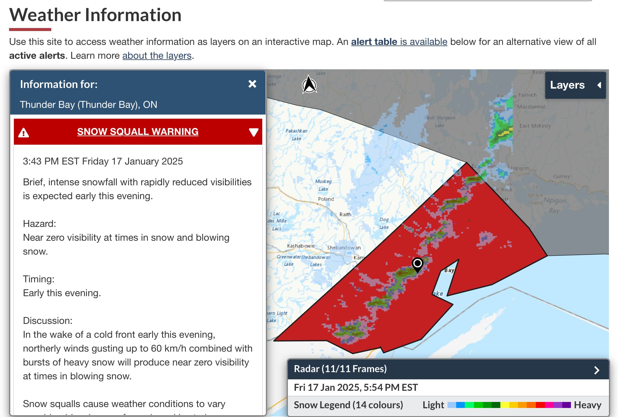
Environment Canada issued a snow squall warning for the Thunder Bay area this afternoon: affected by a strong cold front moving south, strong winds with blowing snow are expected in Thunder Bay tonight, with maximum gusts up to force 7 (60 kph). The southwest-northeast oriented cold front snow band is currently passing through Thunder Bay (the green area on the radar image below). Travelers should be aware of low visibility and wind chill effects caused by blowing snow.

Like: 5Save: 0Comment: 3Views: 18